

Crude Oil Pipeline Spills
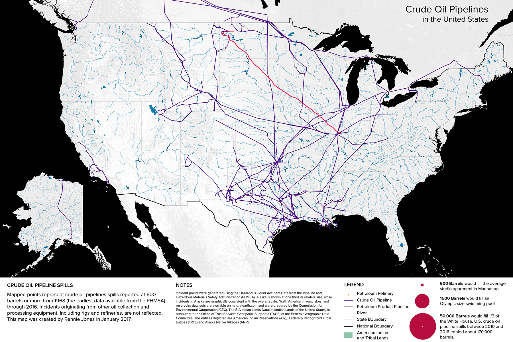
Digital MapWhile the threat posed by the Dakota Access Pipeline to the Standing Rock Reservation’s water supply may seem like a local issue, publicly-available records of crude oil pipeline spills make clear that the issue of energy production and consumption is a national one. I mapped incidents reported to the Pipeline and Hazardous Materials Safety Administration (PHMSA) of 600 barrels (25,200 gallons) or more, from 1968 to 2016. Oil spills originating from refineries or rigs, such as the BP Deepwater Horizon oil spill of 2010 are not reflected. The data show that more than 170,000 barrels of crude oil have leaked from pipelines in the past six years alone. While many of the spills during this period were contained on operator property and partially recovered, most resulted in some form of environmental damage.
Notes
Crude oil pipeline incident points were generated using the Hazardous Liquid Accident Data from the Pipeline and Hazardous Materials Safety Administration (PHMSA). North American rivers, lakes, and reservoirs datasets were prepared by the Commission for Environmental Cooperation (CEC). The BIA Indian Lands Dataset (Indian Lands of the United States) is attributed to the Office of Trust Services Geospatial Support (OTSGS) of the Federal Geographic Data Committee. The entities depicted are American Indian Reservations (AIR), Federally Recognized Tribal Entities (FRTE), and Alaska Native Villages (ANV).