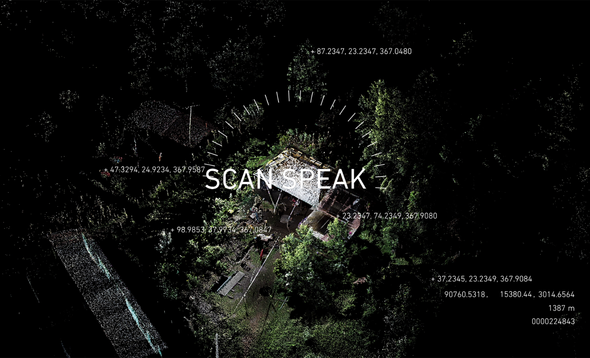

SCAN SPEAK
Graduate Studio Project at Princeton UniversityProject Team: Rennie Jones, Zhi Rui Lim
Instructors: Liam Young and Eyal Weizman
This video is a suggestive response to the use of satellite and lidar technology in rural Guatemala as a means of seizing indigenous lands. The project draws from the work of Forensic Architecture, SITU research, La Fundación de Antropología Forense de Guatemala, and others focusing on this region.
In planning for state-owned infrastructure projects, remote sensing technology is used to create a digital reading of the landscape as valued for its profit potential. These sensors ignore other forms of value, such as cultural and environmental significance, as well as human presence. The three-dimensional scan serves as a model during the infrastructure planning process, standing in as the physical landscape. Whatever is absent from the scan is absent in the planning. Scan Speak is a proposed lexicon of mirrored interventions, which are designed to disrupt the quantification of the data and forestall the planning process. Through the digital disruptions, villagers could demand parlance through scan interference.
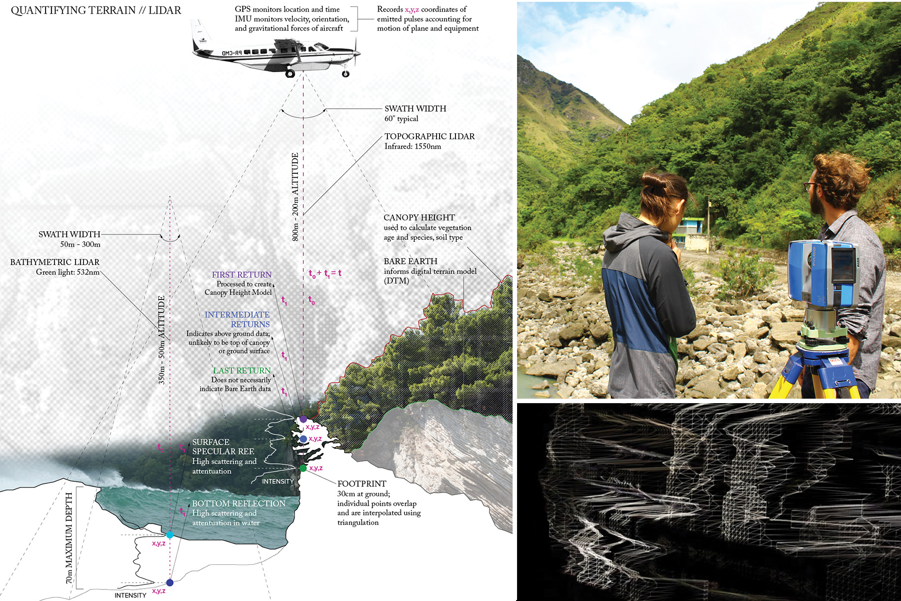
Lidar is a scanning system that uses infrared light to generate three-dimensional digital models. It measures distance by calculating the time it takes for a point to reflect off a surface and return to the scanner, and can provide topographic, biomass, and vegetation data. This type of model is used for cost evaluation and construction sequencing in planning for dams, mines, and other large infrastructure projects. We used lidar ground scanners to create digital point clouds at several significant sites affected by infrastructure projects in Guatemala. Using Depthkit, which combines a Kinect scanner with visual imagery, we approximated lidar scanners and tested ways of collecting and distorting data. These experiments confirmed that mirrors cannot be accurately perceived in a lidar scan.
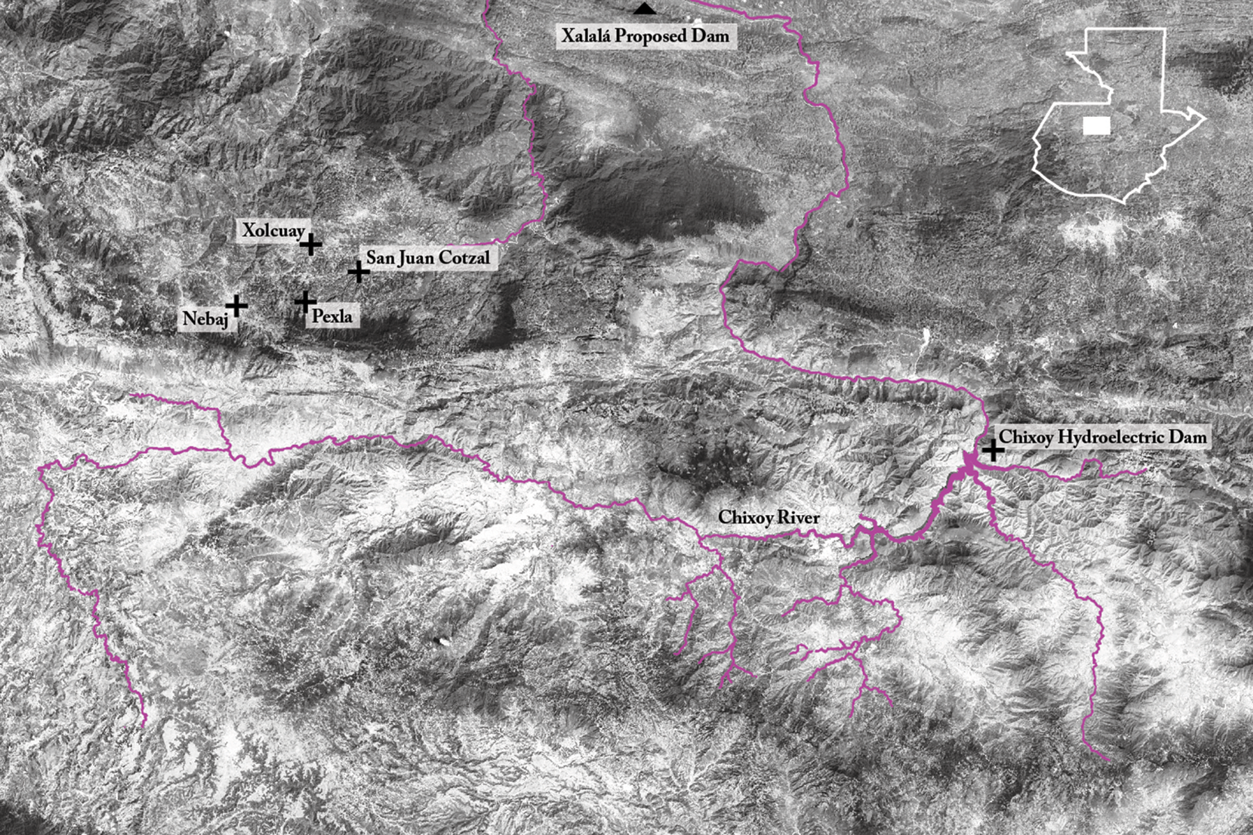
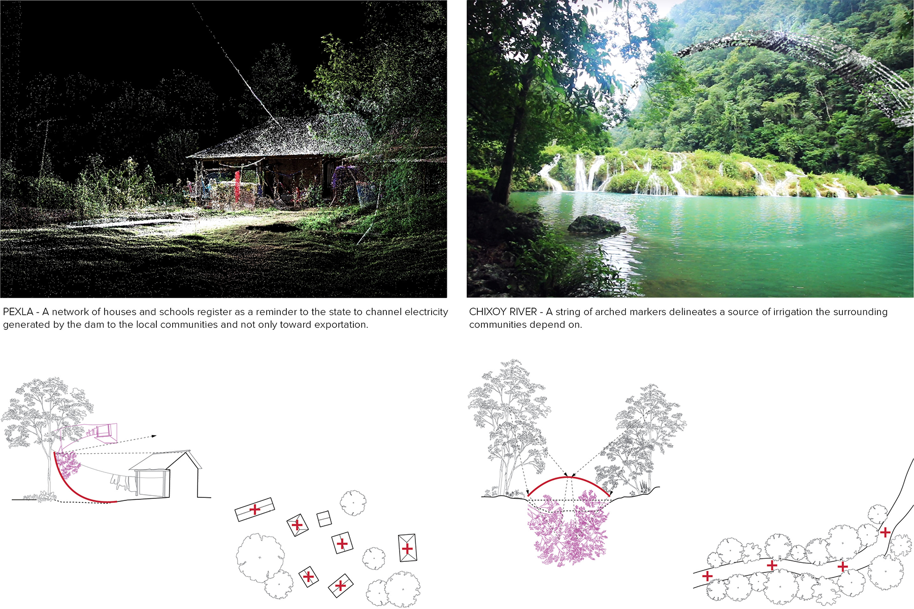
We traveled to the western highlands of Guatemala, the site of military violence against the Ixil Maya indigenous people between 1978 and 1984. These massacres were contemporaneous with those of Rio Negro, in which the military destroyed an indigenous village resisting the development of the Chixoy hydroelectric dam. Our aim was to create a distortion syntax that would allow indigenous villagers to communicate directly with state planning officials through the disruption of lidar scans. At left, the mass grave site of San Juan Cotzal is depicted as a point cloud in the top frame and visual imagery below. The proposed mirrored markers are here intended to register a value system that is otherwise invisible to the scan. They act as a digital protest, asserting the presence of human communities, crops and natural resources, sacred sites, and ecological value.